The water regime of the soil plays a significant role in increasing fertility. Atmospheric precipitation is the main source of soil moisture, but the proximity of water horizons to the earth's surface must be taken into account. Thanks to the groundwater map, it is possible to correctly plan the location of the beds on the site and select types of plant crops adapted to develop in specific conditions.
What is groundwater
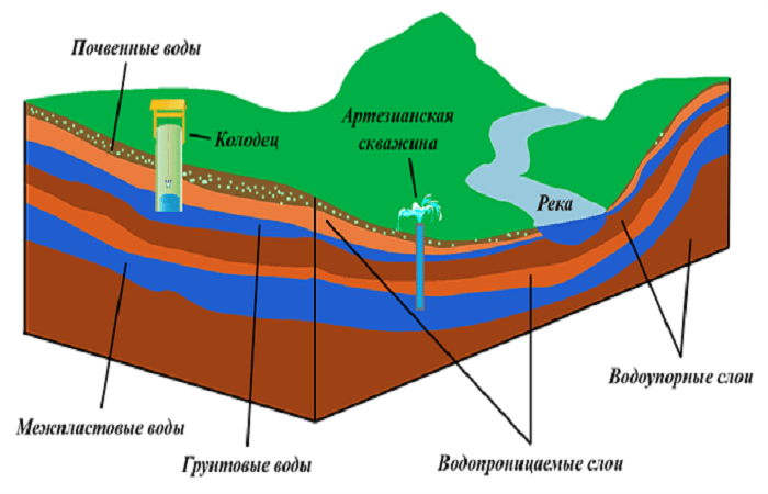
An aquifer located close to the earth's surface contains groundwater that has a free water surface.Most often, moisture is contained in loose, weakly cemented rocks and mountain cracks. The thickness of the horizon is not a constant value and depends on the properties of moisture-containing rocks.
Groundwater horizons do not have the same pressure as artesian ones. Replenishment sources:
- precipitation;
- rivers, reservoirs, lakes;
- underground sources of neighboring horizons;
- water vapor condensate.
The level of occurrence varies by zone and depends on seasonality. In tundra areas, water is located close to the surface of the earth, and in desert areas, water layers are found no higher than 60-95 meters. It is noteworthy that moisture is most often easily accessible for practical use, but pure liquid is rarely found at shallow depths.
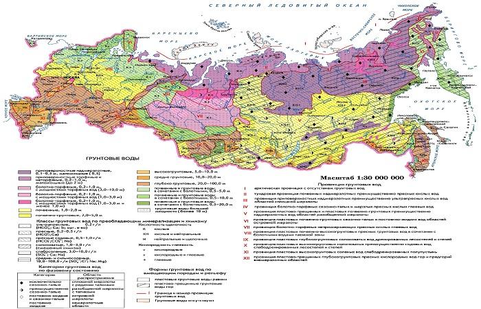
Groundwater map
Quality characteristics and burial depth are important parameters that must be taken into account when choosing a location for a well, when constructing a foundation for a house or any building, when arranging a storm drain or planning beds on a site. It is hydrogeological maps that contain information on the formation of groundwater horizons, features of their distribution and conditions of occurrence.
Several types of maps are compiled according to their intended purpose. Most common types:
- general ones reflect the location of aquifers, describe the composition and characteristics, water abundance;
- maps of the main aquifers reflect their area of distribution, levels and water salinity;
- special ones help assess groundwater reserves and solve water supply problems.
Based on the coverage of the territory, maps are divided into overview, small-scale, medium-scale, large-scale, and detailed.
Table of depths by region
The characteristics of the depth of groundwater must be taken into account when constructing structures (since water gradually destroys concrete), when ensuring water supply to populated areas and industrial enterprises. The easiest way to compare indicators is in the form of a table.
| Name of district/region | Deposition level, meters |
| Moscow | 0,4-10 |
| Orlovskaya | 1,0-5,0 |
| Ryazan | 0,5-6,0 |
| Nizhny Novgorod | 0.2-30.0 (prevails 0.5-6.0) |
| Kaluzhskaya | 0.4-6.5 (maximum – 10.0) |
| Krasnodar region | 0,5-15,0 |
| Rostov region | 0,4-12 |
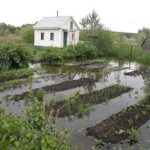
When studying the map of water horizons in Russia, it is necessary to take into account that their depth changes over time, and it is advisable to take into account the parameters of the last 3-5 years. The problem is man-made flooding of varying degrees of intensity in urban areas, caused by fluctuations in horizon levels. This process contributes to waterlogging of the soil, changes in vegetation cover, sliding of slopes, and water entering structures (as in the city of Salsk, Rostov region).
When assessing the water regime of the soil on a site, it is necessary to take into account all sources of moisture. The main moisture of the soil is provided by precipitation and irrigation water. The role of groundwater in the process is determined by its depth and the water-lifting characteristics of the land.

