The soil consists of different layers arranged vertically, which are called horizons. They form the soil profile. Let's consider what soil horizons are, what they are, in what sequence they are located in the profile, how they are interconnected, and how thick they are. What is the soil index, its meaning, classification of horizons.
What is a soil horizon
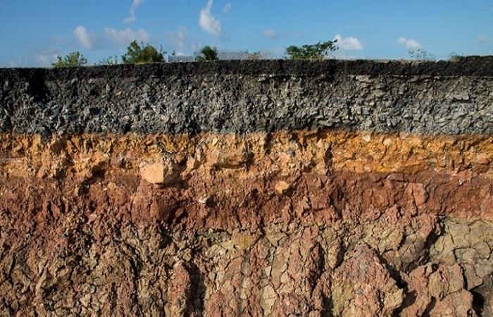
Horizons are soil layers that are formed as a result of the influence of soil-forming processes. They are homogeneous, but differ in morphological characteristics, properties and composition.However, a profile is a combination of interconnected layers that influence each other. They are located vertically, alternately, successive changes in horizons and their types are characteristic of different types of soil.
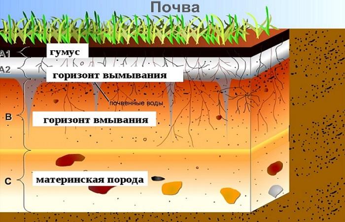
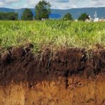
The structure of a typical profile is as follows: the upper fertile layer, followed by a transitional layer, which is adjacent to the parent rock. But in reality, a profile may consist of more horizons or their subtypes.
What are they?
The sequence of layers in undisturbed soils and usually clear boundaries make it possible to visually see their structure. The connection between the structure of the profile allows us to bring the structure of typical soils to a single formula, no matter in what geographical area they are located.
In soil science, various genetic horizons are identified in different types of soils and designated by certain symbols. They are located parallel from the top to the deepest and each go deep a certain number of centimeters. Let us consider the main genetic horizons that are currently identified.
A0
The first top layer is represented by a litter of remains of leaves, small pieces of bark, twigs, and herbaceous vegetation. Organic matter is in a not completely decomposed state. The litter is loose, up to 20 centimeters thick. It partially contains minerals that are not associated with organic matter, but mixed mechanically.
Ad
A turf layer that is covered by plant roots by approximately 50%. When you try to pull out the plants, the turf separates in a lump along with the root system.
A1
A fertile layer containing a large amount of humus, which accumulates here when plant residues rot, which is why it is also called humus.It is dark in color, somewhat lighter in the lower part. Contains 15-35% organic matter, slightly structured, saturated with water.
A2
Eluvial horizon or layer of removal of mineral elements. Located under humus. It differs from it in its light color. In podzolic soils, the eluvial horizon is whitish in color, the humus layer is thin or absent at all. Land in which this layer is well developed is usually not characterized by high fertility. A2 usually contains few elements nutritious for plants; only sparingly soluble compounds remain that are not suitable for consumption by plants.
B
From the eluvial layer, mineral elements are washed out into the underlying illuvial layer. Because of this, it is called the supply horizon. It is dense in structure, has different colors, due to the admixture of humus it can be brown-black, and due to the ingress of aluminum and iron compounds into it it can be brown. When calcium compounds are included, it becomes white in color and is found in forest-steppe and steppe soils. The content of mineral elements is much richer than the previous one.
C
The bottom layer, or parent rock, from which the soil is formed. Its particles mixed with the products of processing organic residues, gradually forming horizons. Beneath it there may be another, deepest layer - the underlying rock.
In primitive soils, the profile consists of only 2 horizons - the upper and the parent rock; it is thin, with an average thickness of 0.5 m.
Index value
Horizons are designated in capital and lowercase Latin letters; Arabic and Roman numerals are also used.The designation is important for determining the profile formula, the presence and location of certain layers.
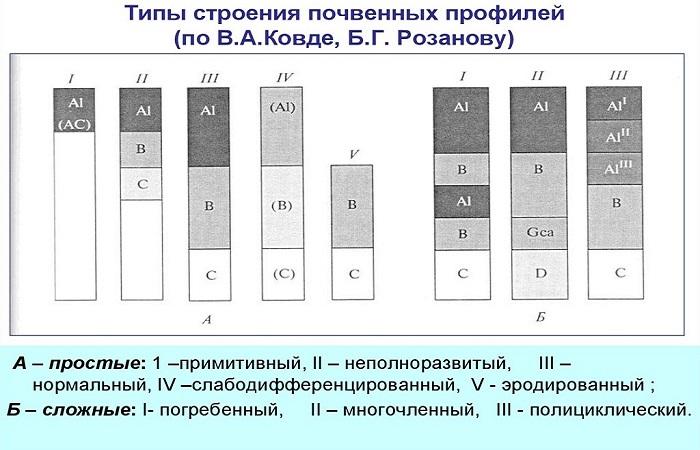
When writing, the letters are separated by a dash; when replacing one layer with another, next to the designation of the main horizon, the designation of the replacement is placed in parentheses. In the same brackets, but separated by a dash, the layer index is written, the presence of which is not required. Transitional horizons, with signs of upper and underlying layers, are designated by indices written next to each other.
Other classifications
The thickness of the profile increases when moving from north to south while maintaining the structure. The thickness of genetic horizons, both basic and transitional, can be different. The profile depth of thin soils does not exceed 50 cm, medium-deep soils - 50-100 cm, powerful soils - 100-150 cm, heavy-duty soils - 150-200 cm and more. The thickness of the humus layer depends on the type of soil; it is most pronounced in chernozems and can reach a depth of more than 0.5 m, and least in northern tundra and desert soils.
There are 2 main types of soil horizons - automorphic and hydromorphic. The former are formed in interfluve spaces, where soil-forming rocks are washed by sediments that filter them, and where groundwater lies relatively deep. Under the influence of washing, chemical compounds and elements move. Hydromorphic ones are formed under conditions of close occurrence of groundwater in river floodplains and at the bottom of ravines.The formation of such soils occurs under the influence of rain, melt and ground moisture. Groundwater brings with it mineral elements that are deposited in the soil.
The boundaries between layers can be vertically straight, but they can also be wavy, broken or blurred. The formula for rocky soil also includes clastic material that is visible on the surface or lies close to it. Rocky soil can be found on outwash ravines, moraine areas, and where there is close occurrence or exposure of semi-rocky or rocky rocks to the surface.
If the clastic material is less than 5%, the soil is considered conditionally not rocky, 5-10% – slightly rocky, 10-20% – moderately rocky, 20-40% – very rocky and over 40% – very rocky.

